Update: Government plans for the Heidelberg Activity Centre includes parts of Eaglemont and Ivanhoe - consultation

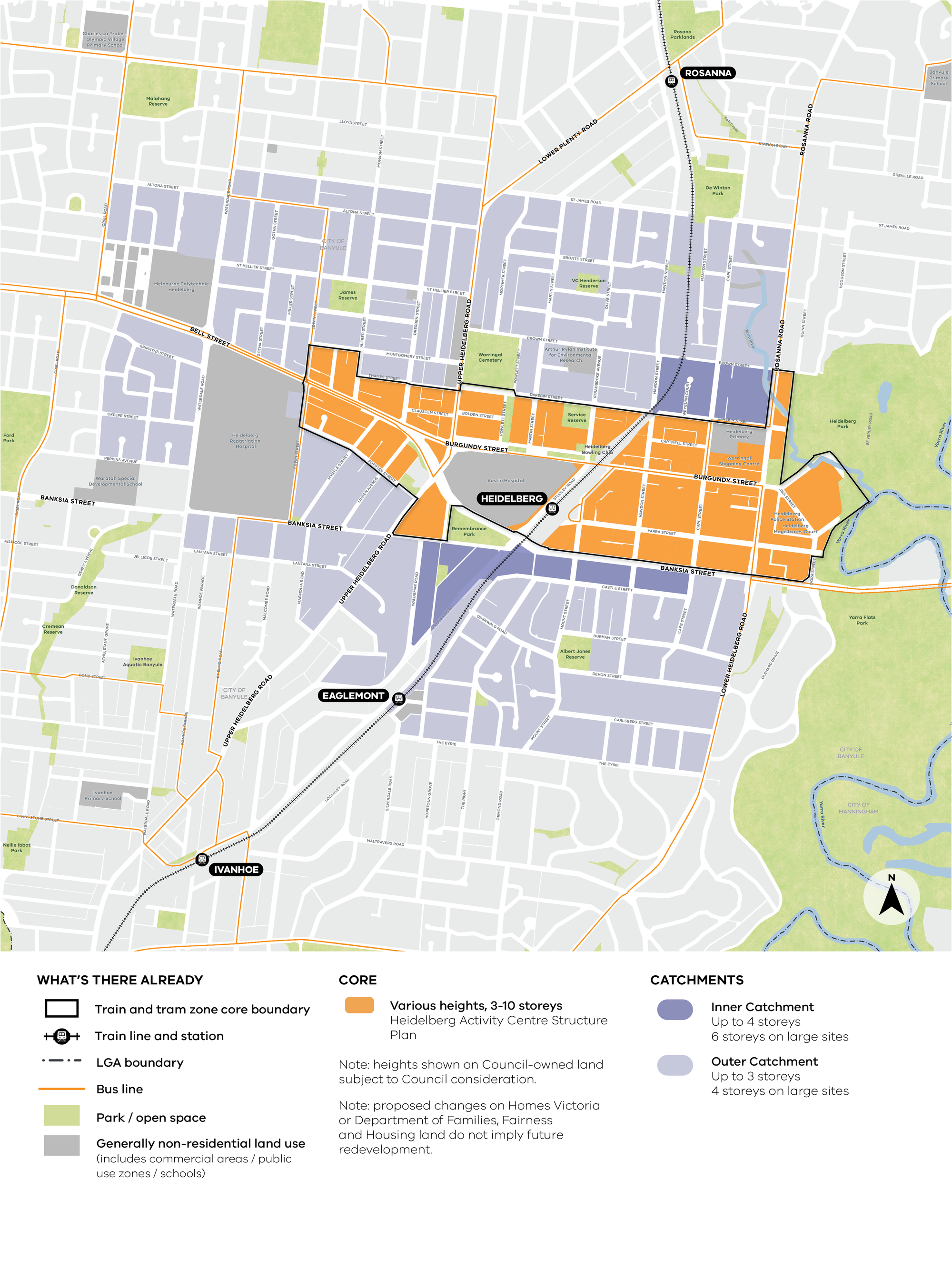
The draft map below is copied from the Engage Victoria information about the Heidelberg Activity Centre and shows the Inner (dark blue: buildings 4-6 storeys) and Outer (light blue: buildings 3-4 storeys) residential catchment areas - the southern and eastern boundaries are The Eyrie and Lower Heidelberg Road.
There is an opportunity for feedback in this second phase of consultation, with a survey on the website (closing 19 October) and a drop-in session on October 18th (Saturday) between 9 and 12 being held at the Uniting Church at 187 Burgundy St, Heidelberg.
The core Activity Centre is shown in orange on the above draft map, and the following link will take you to Heidelberg Activity Centre Structure Plan for more details: https://hdp-au-prod-app-ban-shapingbanyule-files.s3.ap-southeast-2.amazonaws.com/2517/3976/6456/D25_33837__Adopted_Heidelberg_Structure_Plan-February_2025.pdf
Banyule Council is preparing a draft submission about the maps, which is expected to be on the agenda for the meeting of 13 October (published on Wednesday 8 October, usually in the afternoon). https://www.banyule.vic.gov.au/About-us/Councillors-and-Council-meetings/Council-meetings/Council-meeting-agendas-and-minutes
The link below will take you to more information about the Activity Centre program, the survey, and other draft maps

Member discussion